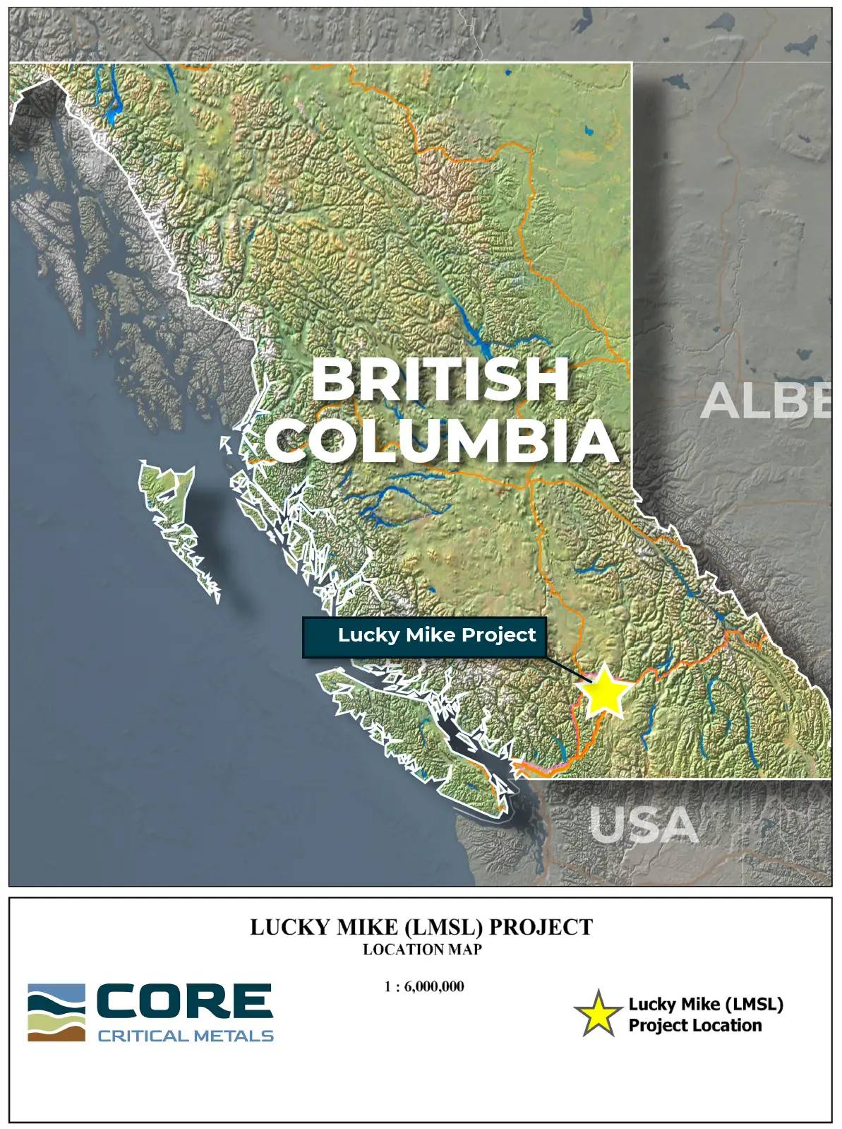
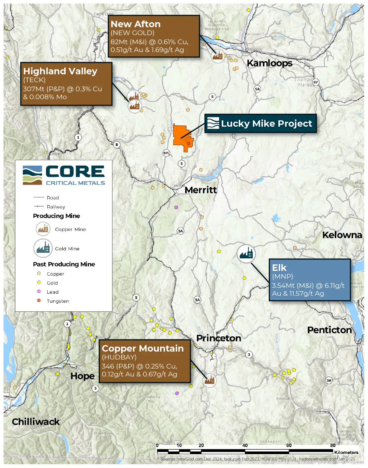
Tier-1 Location in BC’s Premier Copper Belt Located in south-central British Columbia within the prolific Quesnel Trough, adjacent to Teck’s Highland Valley Copper Mine and along a 150-km trend of major porphyry deposits including New Afton and Copper Mountain.
Historic Copper Resource Historic estimate of ~73.5 Mt grading 0.23% Cu (~373 million lbs contained copper)[2]
Copper–Tungsten Critical Metals System Skarn and porphyry mineralization with historic tungsten drilling averaging ~0.312% WO₃ over ~7.6 m widths, highlighting strategic metal potential.
District-Scale Exploration Footprint Extensive ~6.5 km skarn alteration zone interpreted to represent multiple porphyry centers and significant discovery potential.
Drill-Ready with Approved Permits Fully permitted with defined targets, enabling immediate drilling to explore toward higher-grade porphyry cores.
Excellent Infrastructure & Access Extensive logging road network, nearby power and water, skilled local workforce, and close proximity to the Coquihalla Highway between Kamloops and Merritt.
PROJECT HISTORY
The property is situated in the Quesnel trough, one of Canada’s most well-established copper producing regions. Lucky Mike was originally discovered in 1916, and 1,932 Lbs of copper. In the 1940s the claim attracted attention for its copper and tungsten but was not developed. [1]
Historic estimate of ~73.5 Mt grading 0.23% Cu (~373 million lbs contained copper).[2]
Numerous historic Assessment Reports describe the geology and mineralization at the Lucky Mike project are suggestive of a common link to a buried porphyry system. [1]
Adjacent Property
Mine Life Extension (HVC MLE) for adjacent Highland Valley project / details:
In June 2025, the provincial government granted an environmental assessment certificate for the Life Extension project, which officially began construction in August 2025.
Timeline: The extension moves the mine’s closure date from 2028 out to 2046.
Investment: The project involves a capital investment of $2.1 to $2.4 billion, making it the largest critical minerals investment in B.C. history.
Production Goals: It is expected to yield an additional 2 million tonnes of copper over the extended life of the mine.[3]
PROJECT GEOLOGY
Bedrock geology of the property is dominated by Nicola Group volcanic rocks and intruded by granitic intrusions that do not outcrop at surface [1]
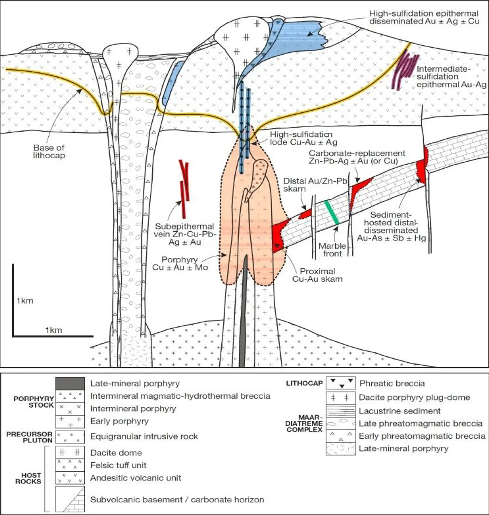
Three main mineralization styles
Copper Porphyry (Rey Lake)
Skarn-type (Lucky Mike)
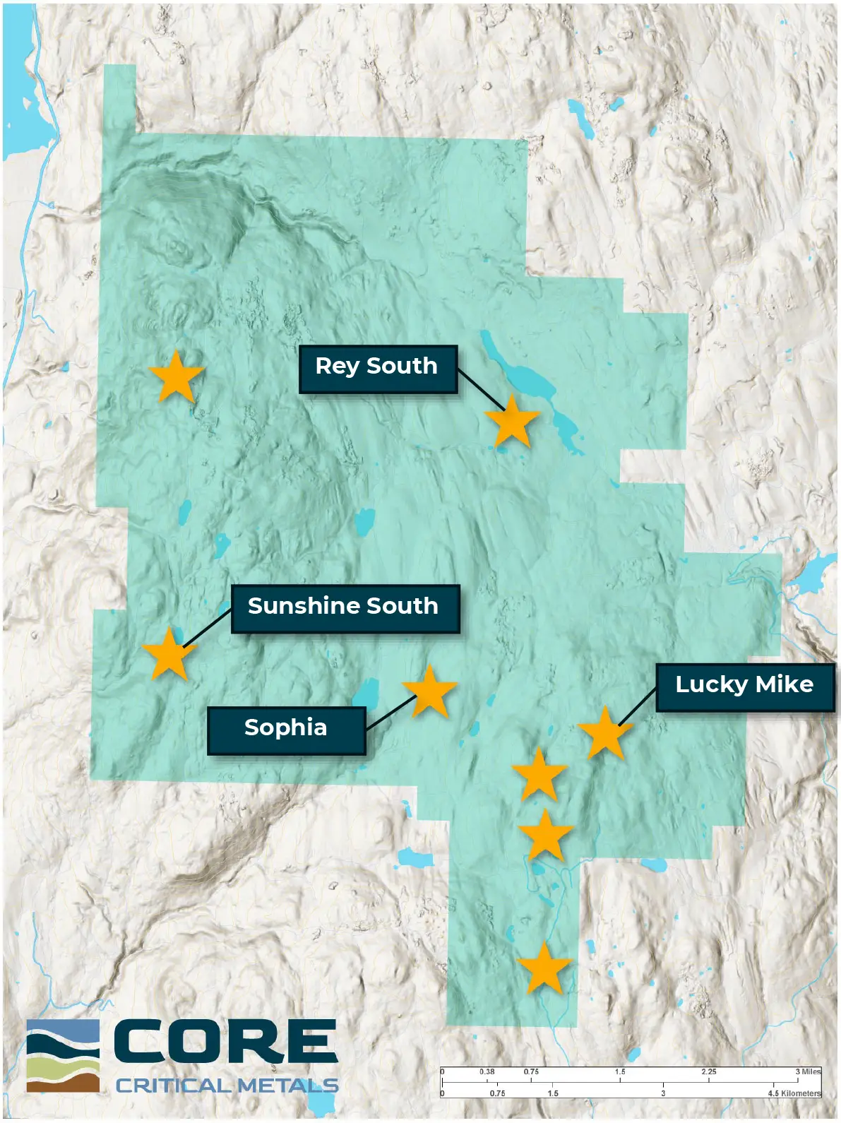
Polymetallic Ag-Cu-Zn-Pb veins (Sunshine, Old Corona, Sophia)
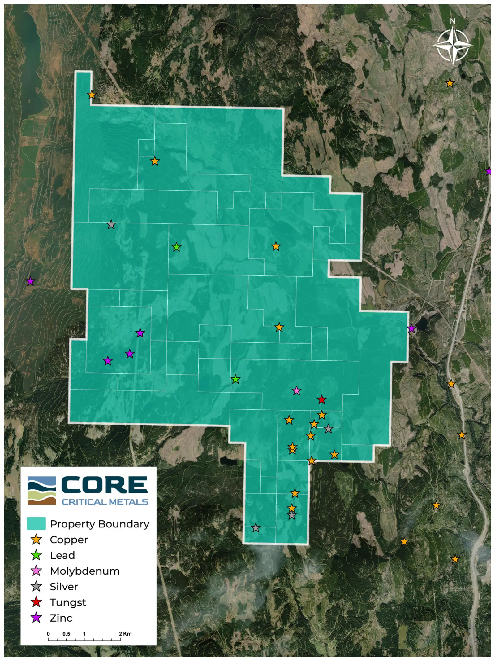
Mineralized trends are up to 5km long in the Lucky Mike-Old Corona areas are associated with northeast trending faults that converge on the historic Rey Lake deposit
Rey Lake Porphyry is possible faulted offset extension from Lucky Mike Area which would combine for a mineralized corridor of 6.5 kilometers long.
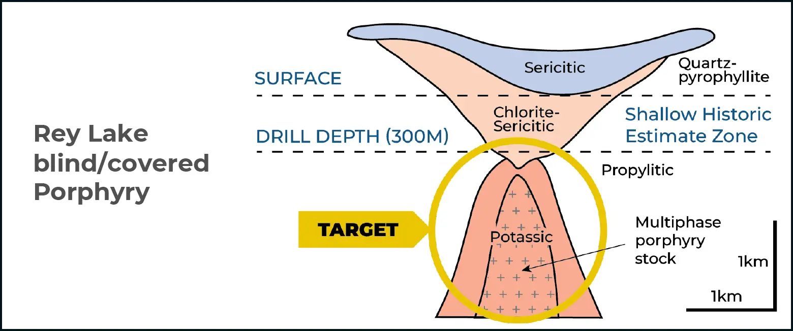
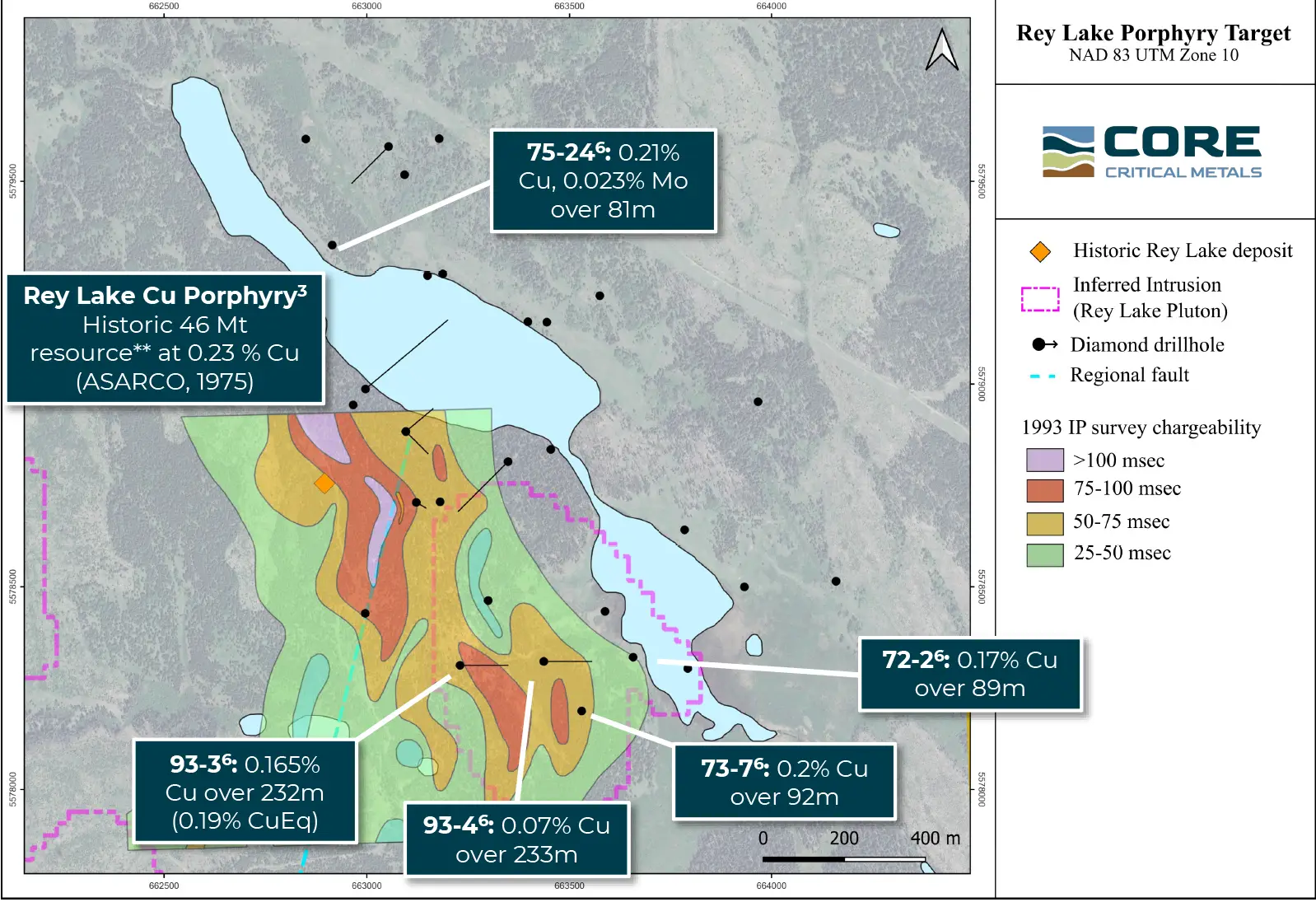
Work will target higher grades in the core of the system to depth and the drill program will test whether copper mineralization continues to depth below historically drilled intervals, particularly the mineralized area in the vicinity of the historic estimate (73.5 million tonnes @ 0.23% Cu).[2]
Alteration of strong chlorite and epidote indicate the shallow drilling was in the “green rock” zone and a higher-grade zone may be present just beneath.
Click image to enlarge
Click image to enlarge
PROJECT MINERALIZATION
There are four main and several minor copper, lead, zinc, and gold showings on the Lucky Mike Property. [1]
Lucky Mike – Skarn – Copper, Silver, Zinc, Lead, Tungsten
Rey Lake – Porphyry – Copper-Molybdenite-Silver +/- Gold
Total Magnetic Field draped over Topography – view from South. Black Squares mark Minfile Occurrences. Ni 43-101 Technical Report_Sep 17th 2012. Click image to enlarge
Mag3D Inversion – Window 1 - Isosurfaces -Elevated view from Southwest. +0.025 SI (Solid Red), -0.015 SI (Solid Blue) – Depth slice through coarse inversion at 500m depth. Ni 43-101 Technical Report_Sep 17th 2012. Click image to enlarge
Click image to enlarge
Rey Lake Copper Porphyry Deposit
Mineralization is associated with fracturing in andesites that are thermally altered and metamorphosed and host disseminated pyrite
Historical mineral resource estimate based on drilling in 1972-1973 (T. R. Tough & Associates, 1974) produced resource estimate of 73.5 Mt at 0.23% Cu[2]
Cu intercepts north of of Rey Lake (75-24) indicates a potential extension and strike length of up to 1200m [1]
Click image to enlarge
Click to enlarge
Lucky Mike Project Workplan
Drill-Ready and Permitted
Led by a skilled team with decades of experience in exploration, and operations, including recent porphyry discoveries. Our upcoming Phase One exploration program is currently in the final stages of development.
District-Scale Potential in a Mining Friendly Region
The Nicola Mining District is home to multiple active mines, excellent local infrastructure and a skilled local workforce. Provincial highways and backroads allow year-round access to the property. Proximity to power, water, and just 20 km north of Merritt.
[1] 2024 Assessment Report on Exploration Activities at the Lucky Mike Property.
[2] Historical Estimate. Original source: Sookochoff (R. Tough & Associates), April 5, 1974 letter, BC EMPR Property File 10721. Secondary: BC MINFILE 092ISE160. Methodology not specified in source; no CIM category. Upgrade would require new drilling and NI 43-101 technical report. QP has not verified; Company not treating as current.