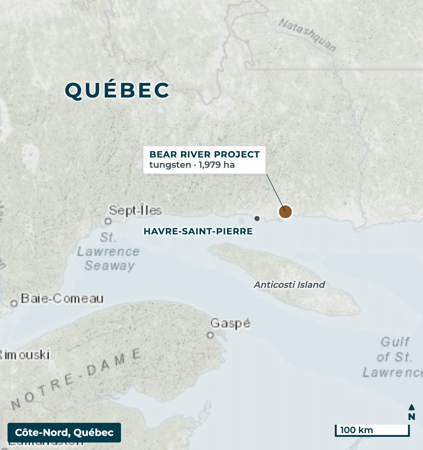
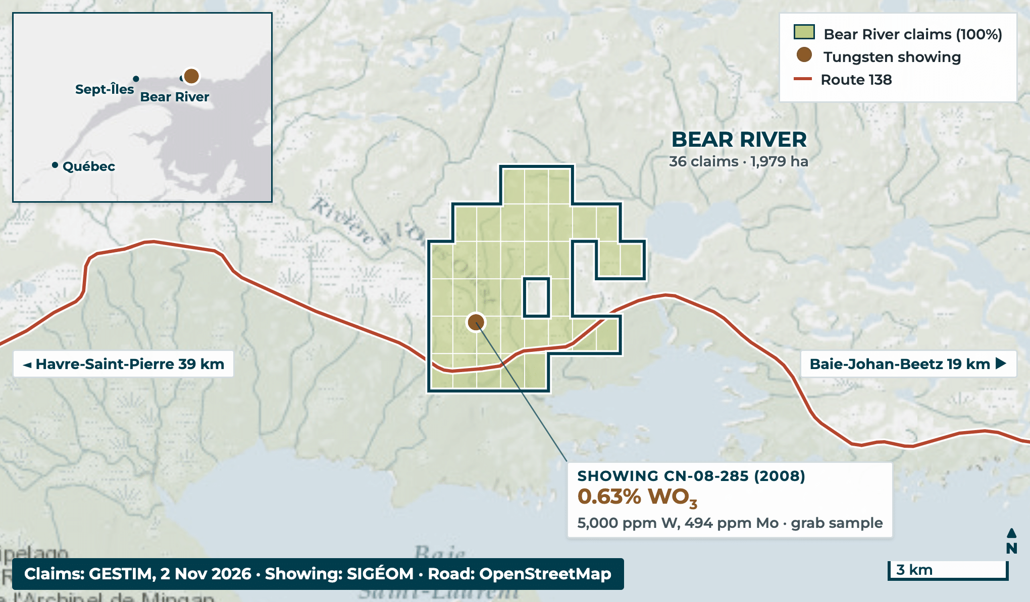
Road access through the claims Côte-Nord, Québec (NTS 12L06), 39 km east of Havre-Saint-Pierre. Route 138 runs about 5 km through the claim block.
100% owned 36 claims covering 1,979 ha. The vendor retains a 2% NSR royalty.
Tungsten at surface Showing CN-08-285, found by prospecting in 2008. A grab sample returned 5,000 ppm W (0.63% WO3) with 494 ppm Mo. No follow-up work is recorded.
Geology Grenville Province. Mineralization is in pegmatite at a gabbro contact, with quartz–tourmaline veins carrying molybdenite, in Wakeham Group metasediments.
Next step First-pass mapping, prospecting and sampling to define targets.
Source: GESTIM claim register (Nov 2026); SIGÉOM showing 8756; government report GM 64450 (2008); company news releases of 9 Jul and 7 Oct 2025.
Bear River Project : CN-08-285 SHOWING
0.63% WO3 at surface, with no follow-up work since 2008
0.63% WO3 (0.5% W), 494 ppm molybdenum and 0.21 ppm rhenium. Showing CN-08-285: one selected grab sample (no. 823363), 2008.
Host rocks: Pegmatite at the contact with an amphibolitized gabbro, cut by quartz–tourmaline veins carrying molybdenite. The tungsten mineral is possibly wolframite.
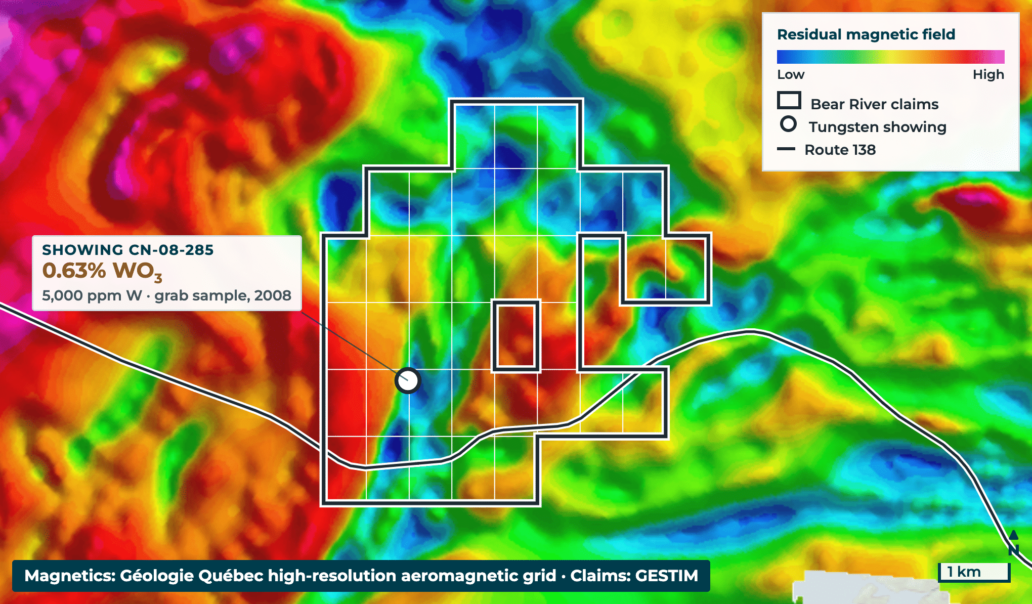
Magnetics: The showing sits on the flank of a magnetic high, next to a magnetic low (see map).
Untested: No trenching, drilling or follow-up sampling is recorded. It is 1.2 km from Route 138.
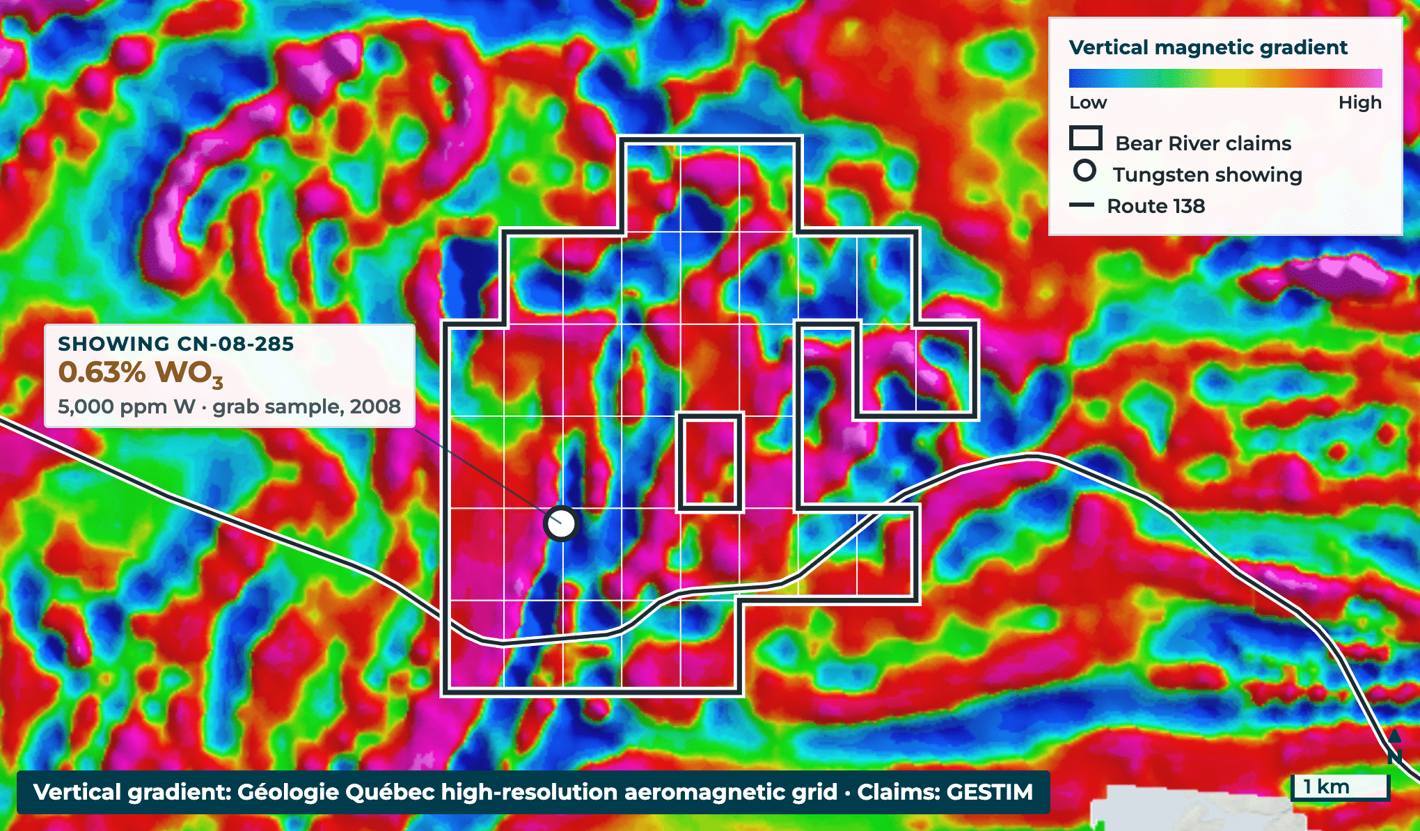
The showing lies on a north-trending magnetic contact
Structure: Magnetic units trend north through the claims. The showing sits where a magnetic high meets a low.
Mineral system: Tungsten with molybdenum and rhenium, in pegmatite and quartz–tourmaline veins at a gabbro contact, in Grenville Province metasediments, granite and gabbro sills.
Data on file: A 2006 helicopter survey (magnetics, gamma-ray, VLF) also covers the claims. Nearest drill holes: 2.6 km (1978).
Source: Géologie Québec aeromagnetic survey DP 2016-06; government reports GM 64450 (2008), GM 62969 (2006) and GM 34418 (1978).